SITE PLANNING FOR
Property redevelopment
CHAPEL HILL, NC | FALL 2020
This group planning project was an exercise in planning the details of a proposed redevelopment project in the urban core of Chapel Hill, NC. The theoretical developer requested a design concept for the redevelopment of a 4.4 acre site in Chapel Hill's Northside neighborhood along the edge of the city's commercial center. Anywhere between 200,000-300,000 square feet of residential, office, and retail space were requested, with 60% of the proposed usable floor area added to the total square footage for parking needs. Environmental factors, town plans and ordinances, urban design principles, and local communities all had to be respected in the final design concept. To begin, our group documented the existing physical conditions of the site in order to inform our ultimate design rationale. After performing our site analysis, we next developed our proposed mixture of uses for the site, the specific locations and forms of those uses, and performance statements for each proposed use. Additionally, our final site concept included explanations for zoning entitlements, automobile accessibility, cyclist accessibility, pedestrian accessibility, emergency vehicle accessibility, stormwater management, vegetation, and climate impact.
Originally, the site consisted primarily of surface parking lots, with two small single-story commercial buildings and three single-story triplex residential buildings. As part of our redevelopment proposal, we requested an upzoning for the entire site in order to introduce a greater density of uses to the location. Working with the existing terrain of the site, we developed our site plan around a central water retention/ stormwater management pond and ephemeral dry creek bed at the land's low point running through the middle of the property and preserved the existing tree canopy at the rear of the site as green amenities for the project. Around these central green amenities we proposed approximately 238,000 of leasable space along with additional parking and public amenities throughout. Along the primary southern frontage of the site, we proposed two four-story mixed use buildings with retail space on the ground floor, office space on the middle floors, and residential space on the top floor. An open air patio space serving a ground floor market and restaurant space was additionally proposed as a street level gathering area to anchor the public point of entry to the site and draw people off the street and into the heart of the property. Behind both of these mixed-use buildings at the front of the site are four-story parking garages with one level of underground parking. The top level of both garages was to be reserved as a greenscaped amenity deck reserved for use by the residents of the two primary buildings with a green wall on the sides of each garage intended to help the structures blend more smoothly into the rest of the site. On the northeast portion of the site we proposed four three-story and four-story residential buildings consisting of sixteen townhomes and apartments. A smaller surface lot behind these residential units is intended to serve the parking needs of those living in the townhomes/ flats at the rear of the site. *(In all subsequent models, red=retail / blue=office / yellow=residential).
Figure 1: Satellite Imagery of Property and Existing Uses

Figure 2: Physical Site Conditions Diagram

Figure 3: Proposed Use Concept Diagram

Figure 4: Zone A / Parking Garage & Amenity Deck 1

Figure 5: Zone B / Mixed-Use Building 1

Figure 6: Zone C / Landscaped Ephemeral Creek Bed & Stormwater Management Utility

Figure 7: Zone D / Mixed Use Building 2

Figure 8: Zone E / Flexible Use Patio & Gathering Space

Figure 9: Zone F / Parking Garage & Amenity Deck 2

Figure 10: Zone G / Central Bioretention & Stormwater Management Pond

Figure 11: Zone H / 'The Grove' - Flexible Use Forested Gathering & Picnic Area

Figure 12: Zone I / Townhomes & Condos
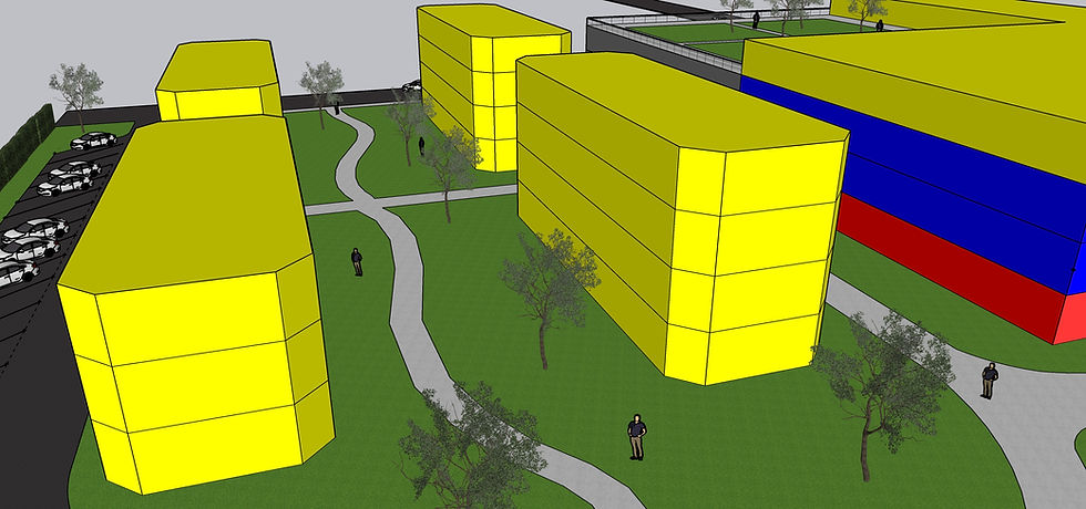
Figure 13: Zone J / Overflow & Townhome Parking Lot

Figure 14: Aerial View from Front of Property

Figure 15: Aerial View from Back of Property
